Spatial Georeferencing Himawari-8 Satellite Images
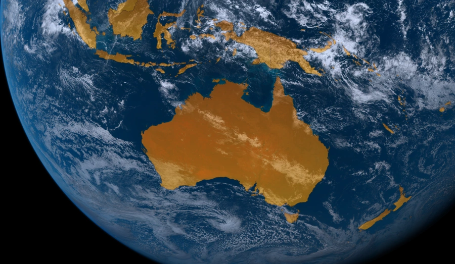
Himawari-8 is a Japanese meteorological satellite that is stationed over East-Asia and Oceania.
Every 10 minutes, it takes a high resolution, full disc image of the earth which you can download from a portal provided by the NICT.
The images are provided in PNG file format and are not georeferenced. If you try to open them in a GIS software package it won't display correctly.
Thankfully this is as easy fix with gdal_translate.
| Argument | Description |
|---|---|
| -a_srs | Assign a Spatial Reference System |
| proj=geos | Geostationary projection |
| +ellps=WGS84 | Ellipsoid to use |
| +h=35785863 | Himawari altitude |
| +lon_0=140.7 | Himawari longitude |
| +a_ullr [corner values] | Corner coordinates of the image |
To calculate the corner values, use this formula
The images are 11,000 pixels and the spatial resolution is 1000m a pixel.
If you open the TIF file in your GIS package and it will be aligned correctly with the rest of your spatial data.
If you wish to reproject to the WGS84 Geographic Coordinate System you can do so with gdal_warp.