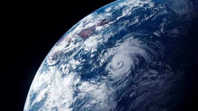
Easy Photo-Realistic Earth Rendering in Blender Using Camera Projection of Satelite Imagery
This is a simple technique for rendering realistic looking earth shots in Blender. I used a satellite that is stationed over Asia & Australia, but you could possibly use the GOES imagery if you're interested in that part of the world.
During Typhoon In-Fas approach to Taiwan in July 2021, I downloaded a few days of the "full disc" imagery from the Himawari-8 Japanese weather satelite. These images are available on a 15m schedule from the NICT website.
In Blender, I created a 3D sphere for the Earth. A camera was positioned at approximately the satelites altitude which was used for the camera texture projection. An animated texture was used to load the image sequence.
No lighting was required as the day night cycle was already an inherent part of the imagery.
I added a second camera at a more artistic angle which was rendered as an animation and composited in Da-Vinci Resolve.